GoFast
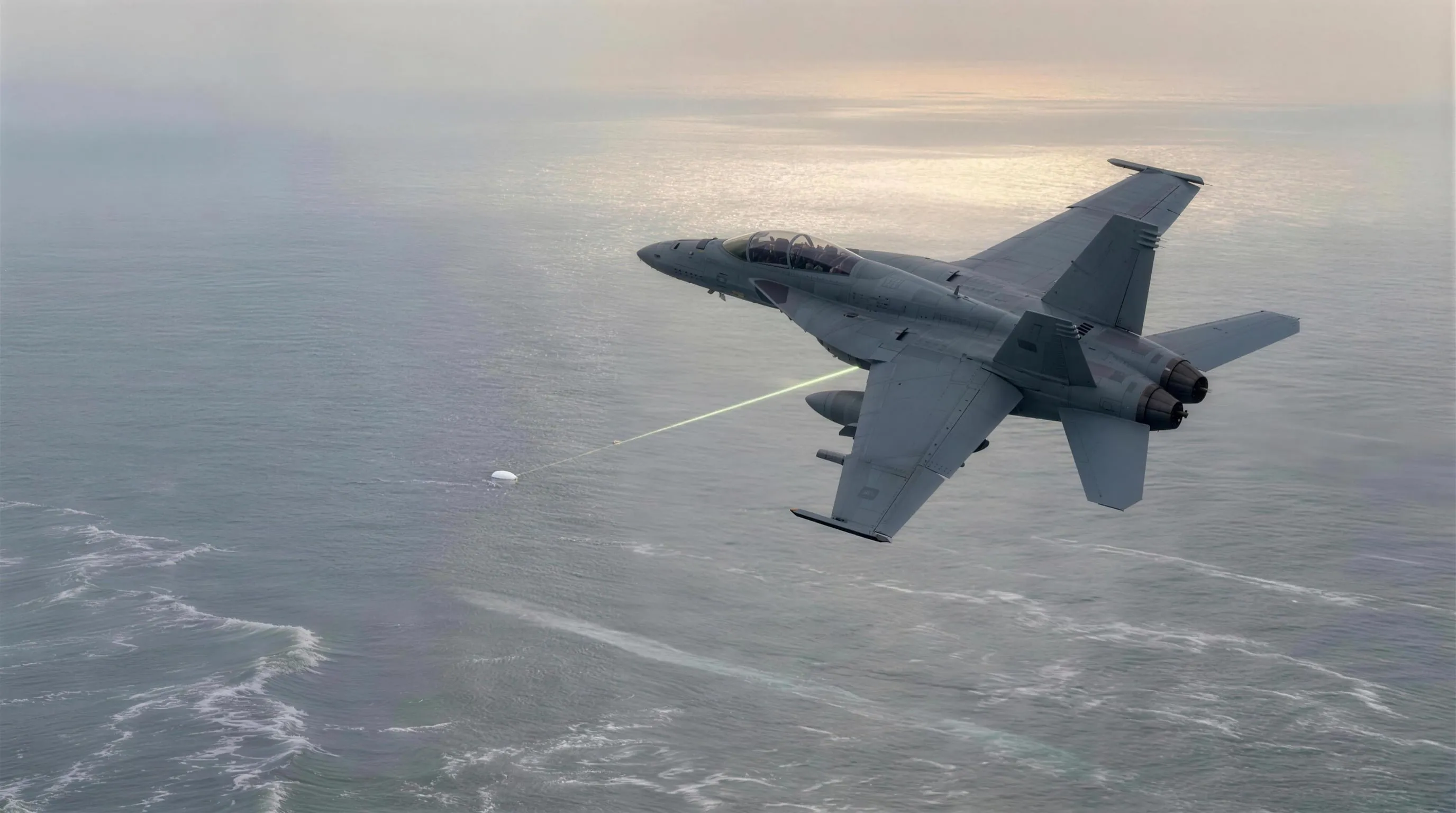
On 21 January 2015, off the US East Coast, an F/A-18's targeting pod locked onto something small and warm, far below, and the cockpit whooped: on the display, a white oval streaked across the sea. Released in 2018 under the name GO FAST, the clip carried its conclusion in its title. But its own margins disagree: the printed range and angles put the object more than two miles above the water, moving at roughly bicycle-courier speed, its racing a gift of parallax from a camera doing 425 mph. This instrument rebuilds the whole geometry and hands you the one dial the video cannot supply, so you can watch the same pixels mean two different worlds.
 Open the interactive ▸
 What you're looking at
The Scene view is the geometry the video hides. A hazy afternoon Atlantic under a Sky-and-Water horizon; the F/A-18 arcing through its reported 15° bank at 25,010 ft; and the recorded line of sight drawn as a phosphor beam sweeping the 22 analyzed seconds. Strung along that ray is the whole family of possible worlds: the solution at your assumed altitude with its speed ribbon and altitude column, and the sea-level ghost, the object your eye assumes, sprinting along the waves with its wake to keep up with the same pixels. One ray, two worlds, one slider between them.
The Screen view rebuilds the ATFLIR display from the calibrated geometry: white-hot blob in the tracking box, live symbology (ALT, CAS, Mach, EL, AZ, and RNG appearing mid-clip exactly as it did), and an ocean background that streams at the true apparent angular rate the camera saw, which is the illusion itself, reconstructed rather than described. Every readout is clickable: what the pod measures, what it displays, and which number the whole case hinges on.
The Solutions view is the argument as one curve: assumed altitude on the x-axis, implied mean ground speed on the y-axis, your dial a moving dot on it. The West/NASA solution sits at the minimum, ~40 mph at 13,000 ft, wrapped in the honest 40-115 mph wind band; the sea-skimmer reading sits at the left edge at ~10× the speed; reference lines price the F/A-18 itself and the bird-balloon-drone cruise range. Six dated cards beneath put the record, 2015 to 2023, one click away.
Why it's here
This is the fourth instrument in this site's UAP wing, and the direct sibling of Tic Tac Kinematics. Tic Tac asks what physics must charge if the reported numbers are taken at face value; GoFast asks the question that comes one step earlier: how the picture itself deceives you. One video, the same pixels: put the assumption at the sea surface and it is a wave-skimming marvel; put it at the 13,000 ft the trigonometry supplies and it is a metre of something warm drifting at bicycle speed. Together the two instruments are one lesson in two halves: audit the perception, then audit the numbers, and leave the conclusion to the reader, always.
It is also the sharpest single application of this site's evidence-tier system. This one clip carries four different strengths of claim at once: the Pentagon's 2020 confirmation (MEASURED: the footage is genuine), the symbology printed in its margins (REPORTED: this is what the instrument displayed), the triangle West 2018 and NASA 2023 computed independently (MODELLED: exact arithmetic on stated assumptions), and what the object was (READING: balloon, bird, drone; the file is open). 'Oumuamua and the crop circles run the same stratigraphy; what makes GoFast special is that all four layers arrive inside the same 34 seconds, and the title happens to rest its whole weight on the weakest one.
How it works
One calibrated scene and one line of trigonometry run the whole instrument; nothing else is asserted.
h = ALT − RNG·sin(EL) · v_front(alt) = |ray(t₁) ∩ alt − ray(t₀) ∩ alt| / Δt · size = slant · θ_blob
The scene is calibrated, not replayed. From the reported CAS and bank the jet flies its true-airspeed arc; the object is placed on the reported 4.4 nmi ray at the triangle's altitude and its drift is solved so the range closes to exactly 3.4 nmi at 22 seconds. The reconstruction reproduces the released symbology, ~26° depression at lock included; the residual unknowns (true heading, exact track) are flagged as liberties, and every derived readout says MODELLED.
The ray family is the core object. Frame by frame, the only geometric fact a tracking camera records is a direction. The instrument stores that direction for all 22 seconds; your assumed-altitude slider intersects the stored rays with one horizontal plane and strings the intersections into a trajectory. Altitude in, trajectory out, speed measured: the entire debate about this clip lives inside that one mapping, and the sliders make it drivable.
The triangle is computed live, not quoted. h = ALT − RNG·sin(EL) runs on the reconstructed values at the current frame; scrub the clip and watch it hold near 13,000 ft. It is the same arithmetic West posted in 2018 and NASA's panel presented in 2023, and it requires nothing but the clip's own margins.
The wind band is the honest error bar. Ground speed is exact given the altitude; airspeed needs the day's winds aloft, which were never published. The wind dial spans ±80 kt and the readouts carry it through: at +40 kt the object is a balloon's definition; at −60 kt it is doing highway speed through the air. The band, 40-115 mph, is NASA's stated uncertainty, made tangible.
The evidence is tagged as you go. The bottom-left table is the conscience of the sim: symbology and cockpit audio are REPORTED, the DoD provenance is MEASURED, the triangle, speed, size and wind band are MODELLED, and identity is a READING. Rows flash as you touch the controls that depend on them, so the boundary between fact, display and model stays visible at all times.
The provenance is measured. The symbology is reported. The triangle, the ~40 mph, and the wind band are modelled, exactly, from stated inputs. And what the object was is the reading this site never supplies. The instrument computes; you conclude.
The four scenarios on the dial
Four positions of the same slider, so the whole argument has somewhere to land.
- As displayed · 13,300 ft. Trust the pod's range lock and the triangle does the rest: the object drifts at ~40 mph, two and a half miles above the sea, in ordinary balloon-and-bird country. This is the West 2018 / NASA 2023 solution, and the instrument's default.
- Sea skimmer · 300 ft. The reading the title sold: pin the object just above the waves and the same 22 seconds of pixels force it to sprint at hundreds of mph, wake and all. Nothing in the video supports this position except the impression it makes; the RNG printed on the frames contradicts it directly.
- Balloon drift · +40 kt tailwind. The solution altitude with plausible winds aloft behind it: implied airspeed falls to approximately zero, the defining signature of a drifting object. This is the configuration NASA's panel leaned toward, and the one a single radiosonde profile could have confirmed.
- Against the wind · −60 kt. The honest upper bound: the same geometry with the day's unknown wind set hostile. Airspeed rises to ~115 mph, the top of the published band, fast for a balloon, ordinary for a bird in a gale or any powered platform. The band is wide; nothing in it is exotic.
The readings, as they stand
Every serious reading of the object, with who argued it and where it lands today. One row is retired, by the clip's own numbers; the file itself is open.
| A sea-skimming, extraordinarily fast object argued by the reading implied by the 2018 release title | RETIRED | Retired, by the clip's own margins. The reported RNG and depression angle put the object ~13,000 ft above the sea; the racing motion is parallax from a 425 mph camera platform. The title does not survive its own symbology. |
| A balloon drifting with the wind argued by the NASA Independent Study's lean, 2023 | OPEN | Open, and the cheapest fit: at plausible winds aloft its airspeed is approximately zero. One radiosonde profile from that afternoon would nearly settle it; none is public. |
| A large bird in cruise argued by discussed since the 2018 Metabunk analysis | OPEN | Open. Size and ground speed fit a large bird; 13,000 ft is high but not unheard of. No wingbeat modulation has been demonstrated in the pixels, and none refuted. |
| A small unmanned aircraft argued by the 2015 Roosevelt workup context; ODNI 2021 lists UAS as a common resolution class | OPEN | Open. The fleet was reporting exactly this problem that season, and the kinematics are comfortable for any purpose-built platform. Nothing in this clip identifies one. |
Try this
- Do the reveal. Start on the Scene view at the sea-skimmer scenario and watch the ghost race, then drag the altitude slider slowly up to 13,300 ft. The sprint collapses into a drift before your eyes: that single gesture is the entire case, and no amount of prose does what the slider does.
- Watch the illusion itself. Switch to the Screen view and let it play. The ocean streams past the locked blob exactly as fast as the reconstruction says it did: your own eye will insist the object is racing. Now glance at the implied-speed readout while believing your eye. That tension is the whole file.
- Catch RNG arriving. Scrub the clip time back to zero and watch the symbology: the range readout is absent, then appears at 4.4 mid-clip, as it did in the released video. Click it and read why that one number is both the case's foundation and its most disputed line.
- Run the triangle yourself. Pause anywhere, read EL and RNG off the Screen view, and compute 25,010 − RNG·6076·sin(EL) on your phone. Compare with the solution-altitude readout. The instrument is doing nothing you cannot check in one line.
- Price every candidate. In the Solutions view, click through the bird band, the wind band and the sea marker, then the six record cards in order, 2015 to 2023. Watch how each new document moved the file: release, triangle, confirmation, panel: and note that none of them closed it.
- End with the audio. Click the crew card last. "Whoa, got it! Woohoo!": genuine astonishment, on the record, at a display doing exactly what the Screen view just showed you. Excitement is data about perception, not about the object. That distinction is this site's whole method, in one exclamation.
Accuracy
The honest line between what is reported, what is measured, what is modelled here, and what is a reading:
| Feature | Tier | What that means |
|---|---|---|
| The symbology: ALT 25,010 · CAS 250 · M 0.61 · RNG 4.4→3.4 | T3 Reported | Printed on every released frame, alongside the ~15° bank in the attitude bars and the ~26° camera depression at range lock. These are the margins of the video: what the pod displayed, reported here exactly as displayed, with the pod's own accuracy left as an open question. |
| Provenance: a genuine Navy record | T1 Measured | The Department of Defense formally released FLIR, GIMBAL and GO FAST on 27 April 2020 "to clear up any misconceptions about whether the footage was real." Authenticity is settled; identity is not, and the two are kept apart on this page. |
| The context: the 2015 Roosevelt "drone" workups | T3 Reported | Crews of the Theodore Roosevelt strike group reported recurring unexplained radar tracks off the US East Coast through 2014-15, later described in national reporting. GIMBAL comes from the same 24 hours. Context, reported; not an identification. |
| The scene: calibrated, not replayed | T2 Modelled | This instrument rebuilds the geometry so the reported numbers come out right: jet arc from CAS/bank, object placed on the 4.4 nmi ray, drift solved so RNG closes to 3.4 at 22 s. The true headings that day are not public; every readout derived from the calibration says MODELLED. |
| The triangle: h = ALT − RNG·sin(EL) ≈ 13,000 ft | T2 Modelled | One line of trigonometry on the reported values, computed live as you scrub the clip. Published by Mick West within days of the 2018 release; re-derived by the NASA UAP Independent Study in 2023. The instrument adds nothing to it but sliders. |
| The speed: ~40 mph ground, 40-115 mph airspeed band | T2 Modelled | String the per-frame solutions at 13,000 ft into a track: ~40 mph over the 22-second window (NASA 2023). The winds aloft that day were never published, so airspeed floats in an honest band; the wind dial hands that uncertainty to you instead of hiding it. |
| The size: 1-2 m at the reported range | T2 Modelled | A ~10-pixel blob in the 640-pixel, 0.7° NAR field subtends ~0.011°. Size rides on the same range assumption as everything else: bird-sized at RNG distance, bus-sized at the waves. The size slider and the altitude slider are one dial in two costumes. |
| The identity: balloon, bird, drone, unknown | T3 Reading | No public identification of the GoFast object exists. A drifting balloon fits NASA's lean; a large bird fits the speed; a small drone fits the fleet context. The instrument computes what each reading requires; it endorses none, and the sea-skimmer of the title is the one reading the reported numbers themselves retire. |
In one line: the Pentagon's confirmation is measured; the symbology, the cockpit audio and the fleet context are reported; the calibrated scene, the 13,000 ft triangle, the ~40 mph and its 40-115 mph wind band are modelled, exact arithmetic on the clip's own margins; and what the object was, balloon, bird, drone or unknown, is a reading, the one this site leaves to you. The video was real. The speed was parallax. The instrument keeps those two sentences from being confused with each other.
Sources
- US Department of Defense (27 Apr 2020). Statement on the Release of Historical Navy Videos. The official release of FLIR, GIMBAL and GO FAST, confirming authenticity.
- To The Stars Academy (9 Mar 2018). "GO FAST" release and commentary. The clip's public debut, filmed 21 January 2015 by an F/A-18 of the Theodore Roosevelt air wing.
- West, M. (2018). "GO FAST" Footage: Bird? Balloon? Metabunk thread. The original public triangle: ~13,000 ft, ~30-40 kt, from the on-screen symbology alone.
- Parabunk (2018). Analysis of TTSA 2015 Go Fast UFO video. Independent frame-by-frame derivation: object altitude ≈ 4,040 m, speed ≈ 77 km/h, size ~1 m.
- NASA UAP Independent Study Team (2023). Final Report, pp. 28-30 (J. Semeter). The panel's GoFast walkthrough: ~40 mph over 22 s, "most likely drifting with the wind," wind data caveat.
- Metabunk (2021-22). ATFLIR and range information; the Lehto interpretation threads. The RNG-accuracy dispute, documented on both sides.
- Office of the Director of National Intelligence (2021). Preliminary Assessment: Unidentified Aerial Phenomena. The reporting framework and the UAS/airborne-clutter resolution classes.
- Cooper, H., Blumenthal, R., & Kean, L. (2019). "Wow, What Is That?" Navy Pilots Report Unexplained Flying Objects. NYT. The 2014-15 Roosevelt context, on the record.
- Raytheon / US Navy (public specifications). AN/ASQ-228 ATFLIR. Fields of view, modes and the pod's sensing envelope used by the Screen view.
- NAVAIR (2020). FOIA release metadata for the three Navy videos. Dates, designations and custody chain.